LiDAR has emerged as a groundbreaking technology for capturing spatial data related to power transmission lines. This advanced method delivers precise measurements of both the geometric layout of power lines and the proximity of vegetation or objects near electrical networks, enhancing the accuracy of utility mapping.
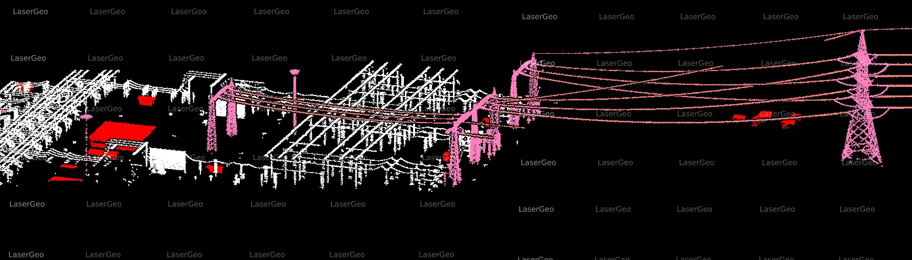
By combining LiDAR data with field observations, it is possible to optimize the mapping and management of utility networks while significantly reducing the costs associated with traditional grid design, maintenance, and inspections. Using LiDAR and imagery for both transmission and distribution networks enables the creation of accurate 2D and 3D models, which can be delivered to clients globally at cost-effective rates.
At LaserGeo, we pride ourselves on utilizing advanced LiDAR data processing to deliver tailored solutions for electric network analysis. Our customizable software enables us to conduct specific assessments, considering parameters such as voltage, span, poles, and towers. These analyses produce essential insights for utilities, aiding them in efficient maintenance planning, prioritizing tasks, and enhancing overall network management.
With our expertise in LiDAR applications and software development, we have designed proprietary tools and algorithms. These tools are fully adaptable to project-specific requirements, ensuring high-accuracy outcomes and competitive pricing for our clients. Our goal is to offer solutions that align with each client’s unique needs, supporting their objectives with precision and reliability.
Extensive Capabilities with LiDAR Technology
Leveraging our experience and quality assurance techniques, LaserGeo provides fast and reliable results for electric network mapping and management. Our offerings include:
- Utility Mapping and Inventories: Documenting crossings, structures, and network assets.
- 2D and 3D Power Line Models: Creating detailed visualizations of electric networks.
- Vegetation Management and Clearance Analysis: Ensuring safety and compliance standards.
- 3D Planimetry: Capturing topographical details with precision.
- PLS-CADD Modelling: Generating advanced designs for grid systems.